
Next Generation 911 GIS Services
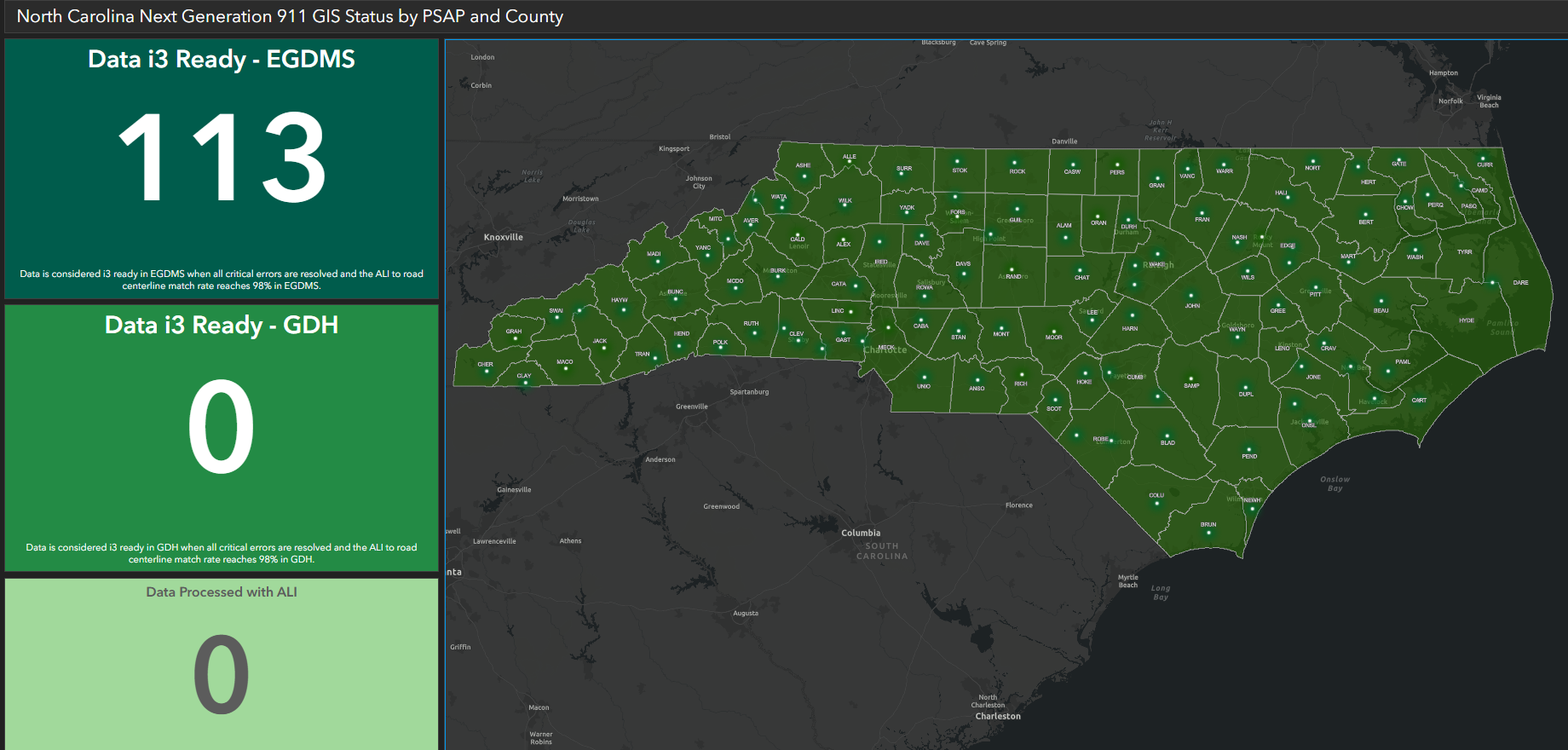
GIS Connection and Upload Status
What Next Generation 911 GIS Does
The N.C. 911 Board has developed a statewide geodatabase within the Next Generation 911 system to accurately identify 911 callers' location and route them to the appropriate PSAP.
The geodatabase aggregates and validates geographic information system data from all 124 PSAPs in North Carolina. Next Generation 911 allows 911 calls to be mapped by coordinates or address locations.
In the Next Generation 911 system, when the location of a 911 caller is identified by a new landline or digital service, it is validated against the GIS data before the 911 call can be placed. If a 911 call cannot be validated by the GIS, there might be a delay routing the call to a PSAP.
GIS data is used to protect life and safety. Consequently, GIS data on addresses and service area boundaries need to be accurate, up to date and seamless across the state. Data quality – its accuracy, validity, consistency, timeliness and completeness – and sustainable data maintenance workflows are of paramount importance.
How GIS Works with Next Generation 911
Local agencies maintain their own GIS data and submit it to the state through GeoComm's GIS Data Hub. Submitted data is automatically loaded into the state’s standardized the Next Generation 911 GIS database.
GeoComm provides managed services to aggregate data from local agencies and assist in identifying and reporting any gaps, errors and discrepancies in GIS data.
Local agencies that maintain the authoritative data required for the Next Generation 911 are also responsible for remediating any errors and discrepancies identified by data validation checks provided through the GIS Data Hub.
Local GIS authorities clean up and maintain the required data. They also coordinate with neighboring jurisdictions to ensure that there are no gaps, overlaps, or redundancies in any of the required datasets.
Frequently Asked Questions
Local agencies can use the following frequently asked questions to understand the importance of GIS data in the Next Generation 911 system and to identify what it will take to meet requirements.
- Road centerlines
- Address points
- PSAP boundaries
- Emergency service boundaries
- Provisioning boundaries
This is your area of responsibility for the GIS data you upload into the GIS Data Hub. This single polygon should be identical to the coverage area of all your PSAP boundaries. You need a polygon boundary around all the data you are responsible for maintaining. The emergency service boundaries will also need to cover this same area.
Your ALI database table can be downloaded from the AT&T PSP system. If you are unsure of how to do this or weren’t trained on the system, please reach out to the NMAC team for guidance. The NMAC team can be reached by email at 911NMAC@nc.gov.
Your ALI database extract should include all PSAPs (Public Safety Answering Points) for which you are maintaining GIS data. In most cases this is a single PSAP in the county, but there are a handful of GIS providers that maintain data for the county and a city with a separate PSAP.
We have provided a table that lists the required attributes for each required and recommended layer. This table follows the NENA GIS Data Model standard. Please visit this NENA document for more information on the Civic Location Data Exchange Format (CLDXF) fields for the street name attributes.
The XML of the NENA schema and the field mapping spreadsheet are both part of the NG9-1-1 GIS GeoComm Tool package, which may be downloaded from the Associated Files section below.
As often as you would like! After you upload and process your data, you should receive your results within one to two hours. After you receive those results, you can upload again at any time. Feel free to upload and process your data after you have made updates to see how those changes have affected your results and score.
No, not currently.
If your mutual aid boundaries fall into your neighboring jurisdiction’s PSAP coverage area (calls are routed to your neighboring PSAP), you should split the emergency service boundaries at the PSAP boundary and add an exception code of “999” to the polygons that fall outside of your PSAP boundary. There is no need to remove them before uploading into GIS Data Hub. The “999” code will take care of this. Your neighboring jurisdiction should submit these polygons with the rest of their data to ensure 100% emergency service boundary coverage of their PSAP and provisioning boundary.
The legacy street name fields, MSAG community and ESN fields are intended for legacy system purposes. Any additional CAD system and GIS data required fields can be maintained in addition to the NG9-1-1 schema fields.
Roads that run along a boundary should run coincident (snapped to each vertex). The ranges for the neighboring jurisdiction’s side should be attributed 0-0. The neighboring jurisdiction should do the same, so no overlapping ranges are introduced into the statewide dataset.
If a road weaves in and out of a county, it should be broken every time it crosses a boundary. Alternately, if it is more efficient to have a specific responder responsible for the whole road, then the boundary of the PSAP responsible for dispatching that responder could cover the entire road. Keep in mind that the provisioning boundary and the emergency service boundaries need to completely cover this PSAP boundary, and this plan needs to be coordinated with the neighboring jurisdiction.
The 999 exception code may also be used to exclude features in your dataset that weave in and out of your county and are maintained and submitted by the neighboring jurisdiction. Features with the 999 exception code are removed as part of the GIS Data Hub ingest process before quality checks are run. These features will also not be aggregated into the statewide dataset.
A very low synchronization rate can be caused by incorrect or missing field mapping. We suggest double-checking your field mapping of ALI, roads and address points. The fields used in the synchronization check are:
- House number in address points and ALI database
- House number suffix in address points and ALI database
- Legacy street name components (parsed) in address points, road centerlines and ALI database
- Ranges in road centerlines
- MSAG community in address points, road centerlines and ALI database
Once a month is the suggested minimum to ensure that new records are validated, but it can be requested and uploaded with your GIS data as often as you wish.